Introduction to Yellowstone Geyser Basins
What is a Geyser Basin
A basin is a cluster of hydrothermal features in a specific area. Hydrothermal features are typically concentrated around the margins of lava flows and along fault zones, and are often, but not always, in low-lying areas.
The main, easily accessible basins in Yellowstone are listed in alphabetical order as follows:
Gibbon Geyser Basin
Located between Madison Junction and Norris Geyser Basin. Gibbon Geyser Basin has many accessible features, including:
- Artist Paintpots, 1 mile (1.6 km) trail. At this point, you can go right or left, go right. That takes you up the hill, and the rest is downhill.
- Beryl Springs, by the roadside.
- Monument Geyser Basin, 2.4 miles there and back trail. The 600-foot elevation gain in 0.6 miles.
- The Chocolate Pots, by the roadside.
Artist Paintpots is a colorful area. The two mud pots at the top of the hill are my favorite mudpots. A dirt wall separates them. They typically have different amounts of fluid, causing them to behave differently. The west one is generally drier, so the action is noisier and can spit mud up to 20 feet away. The east pool is soupy, more like watching a pan of water boil.
Lone Star Geyser Basin
Locate the parking for the trailhead at the east end of the Kepler Cascade parking. It is a 4.8-mile round-trip hike on an old service road through the woods beside the Firehole River. It is a peaceful and pleasant walk. Bikes are allowed. The broken road surface can be bumpy. Please pay attention to the road surface and walkers.
Lone Star Geyser is 2.4 miles from the trailhead, marking the usual turnaround point for this hike.
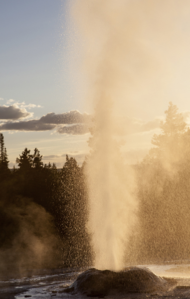
Lone Star Geyser erupts every three hours. Visitors often ask the rangers when the next eruption will be. No monitoring is done on Lone Star Geyser, so the rangers can’t answer that question.
At Lone Star Geyser, there is a podium containing a logbook. NPS encourages people to document the date and time they observe an eruption in the logbook so others can see when the geyser last erupted. Recording in the logbook is another way to be a citizen scientist because the park will use that data.
Lower Geyser Basin
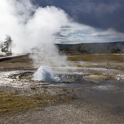
The Lower Geyser Basin is five square miles of widely scattered features. Two of the largest, easily accessible areas are Fountain Paintpots and Firehole Lake Drive. Fountain Paintpots contains one of Yellowstone's most extensive assortments of features. Firehole Lake Drive contains Great Fountain Geyser, White Dome Geyser, Pink Cone Geyser (see picture below), hot springs, and Black Warrior Lake.
Fountain Paintpots is home to a large pink mudpot, Silex Pool, Celestine Pool, Clepsydra Geyser, and Fountain Geyser.
Fountain Paintpots is mainly flat, but there are stairs going from the mudpots down to Clepsydra and Fountain Geyser. You have access to all the area, but you will have to backtrack to the Celestine Pool intersection twice. (See below for an accessibility note.)1
Midway Geyser Basin
Midway Geyser Basin is home to the world-renowned Grand Prismatic Spring. Grand Prismatic is the largest hot spring in Yellowstone and the third largest in the world. It is over 121 feet (37 m) deep and has an approximate diameter of 370 feet (112.8 meters). As of 2016, people can now get a high view of this beautiful hot spring. Access the Overlook from the Fairy Falls parking lot, walking 3/4 of a mile from the bridge. Take the prescribed path up the hill on the left side of the trail.
Also in Midway Geyser Basin is the home of Excelsior Geyser's crater. The crate-creating eruptions occurred in the late 1800s. (See image to the right.)
The path to this basin takes you over the Firehole River near the runoff from Excelsior Geyser. The boardwalk is a switchback up to the top. Once up the hill, the boardwalk is level. I have seen motorized wheelchairs easily navigate the incline. Using a manual wheelchair will depend on the operator's ability.
The view at Midway Geyser Basin gives you a ground-level, close-up look at the beautiful bacteria mats. The Overlook will provide you with a more sweeping aerial view. The overlook trail is flat. The hill isn't. Based on your health (bad knees/hips, respiratory, or heart problems), going up the trail can be a challenge. Go slow if you try, and step to the side to get your breath as needed.
Norris Geyser Basin
You will find Norris Geyser Basin at the Norris-Canyon junction on the Grand Loop Road. The 2.25 miles (3.6 km) of earth and boardwalk trails branch into Back Basin and Porcelain Basin.
Norris Geyser Basin is the home of Steamboat Geyser, the tallest active geyser in the world. Steamboat's intervals range from 5 days to 50 years. But on March 15, 2018, Steamboat entered a period of very active eruptions, with eruptions occurring a few days apart. It had only eight eruptions in 2023, 6 in 2024, and only three in 2025. The last eruption of the year was at 1002 pm on December 31, 2025. When will it go into another dormant period? Standby, I will get back to you on that.
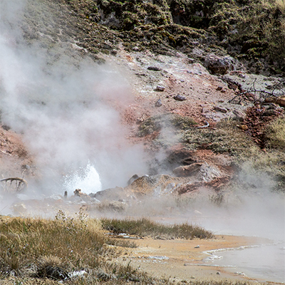
Norris is a very different type of basin. Most of the features in the other basins are alkaline, whereas Norris's features are primarily acidic. Many of these features have pH in the 2-3 aciditic range. Norris is the third-largest geyser basin in Yellowstone, both in size and number of geysers.
Because of the acidity, the features in Norris have a different look, and other bacteria grow in the area, giving you a variation of colors. Most pools have a milky appearance due to suspended particles in the water.
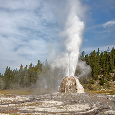
Upper Geyser Basin
The Upper Geyser Basin comprises the Old Faithful area, Biscuit Basin, and Black Sand Basin.
The Old Faithful area is the home of 5 predictable geysers: Old Faithful, Castle, Grand, Daisy, and Riverside. Grand is the tallest predicted geyser in the world. Three geysers erupt during a Grand eruption. Check the Basin menu above to read about other geysers or basins featured on this site.
The Upper Geyser Basin has the largest collection of geysers in the world, with 150+ in a 1-square-mile area. Geyser Hill, across the river from Old Faithful, is the home of 50+ of those 150+ geysers.
Annually, 90% of visitors to Yellowstone come to the Upper Geyser Basin to see Old Faithful Geyser and the general area. One "must-do" in the Upper Geyser Basin is stepping into the Old Faithful Inn. This beautiful building, built the same year the Wright Brothers did the first powered flight, is just a super wow experience.
Be aware that bison are in this area all of the time. Please keep yourself and your family safe by staying at least 25 yards away from these huge wild animals. What is the saying? "Look, but don't touch."
West Thumb Geyser Basin
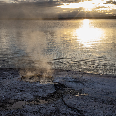
While it is a smaller basin with fewer geysers, this basin sits on the edge of Yellowstone Lake. If you are into sunrise pictures, this is a great spot, as shown in the photo to the left.
There are some inclines, but they are mostly straightforward. Just take it slowly, as your body dictates.
You may see elk about, especially in the fall. Please, like with bison, keep your distance. The trees are also an excellent place to look for birds you may not see in your home area. I have almost always seen a Snowshoe Hare when I visit this basin. Look for the ephydrid flies on the hot water. Yes, on the hot water. They mate in the hot spring, and their larva eats the bacteria. They are, in turn, eaten by spiders that inhabit the hot water. Flies can live on water up to 109°F (43°C).
You can access Heart Lake Geyser Basin and Shoshone Geyser Basin with more hiking. Since the other basins are off-trail and many are off-limits, I will not discuss them here.
Mammoth Hot Springs is another accessible area where you can see the amazing geothermal sights of Yellowstone. At Mammoth, the geology is different. Underground, the water comes up through limestone. The water deposits calcium carbonate that forms travertine, creating the beautiful terraces you will see.
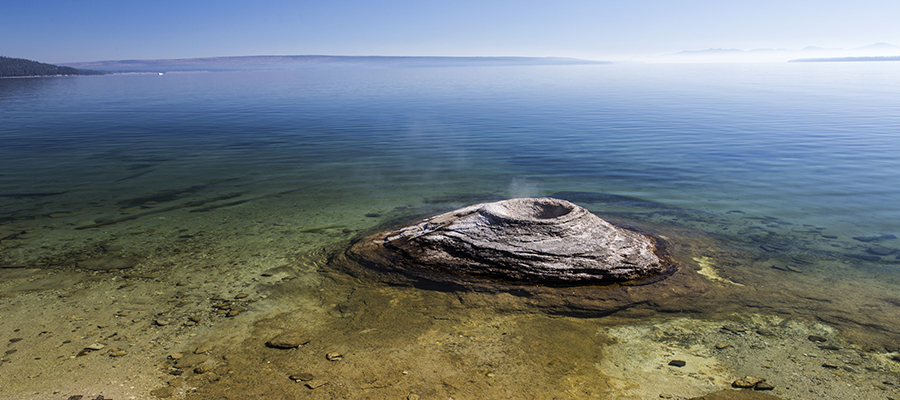
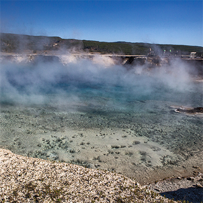
Fishing Cone Geyser
Fishermen used to stand on the cone, throw a line, catch a fish, and then dip it into the geyser to cook. That is illegal now because of the risk of damaging the cone and the heavy metals that would be absorbed by the cooked fish.

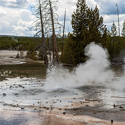
Artist Paintpot - Mudpot
One of the fun things to do is watch the mudpots splashing when the moisture content is just right. You are treated to all kinds of shapes and sounds.

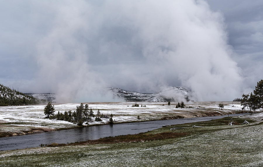
Frosted Trees
Trees frosted from the heavy steam coming from Midway Geyser Basin. Makes for a beautiful memory of the Firehole River, Midway Geyser Basin, and an old log bridge.
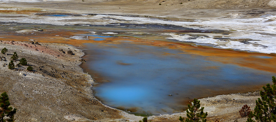
Porcelain Basin Hot Spring
Porcelain Basin Hot Spring is milky blue due to the mineral siliceous sinter. The blue indicates it is hot, up to and over boiling—suspended minerals in the water cause the cloudiness.
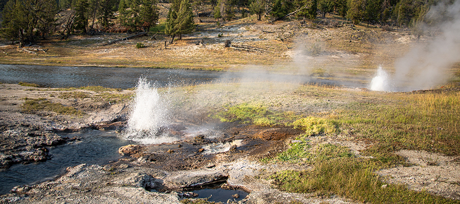
Two for One
Artesia Geyser, front, and Young Hopeful Geyser at play near Firehole Lake on the Firehole Lake Drive.
1If you have accessibility issues, please ask at a Visitor Center desk or entrance gate for the Accessibility Guide.